Administratively the mountain is in the area of three districts: East Lombok, West Lombok and Central Lombok.
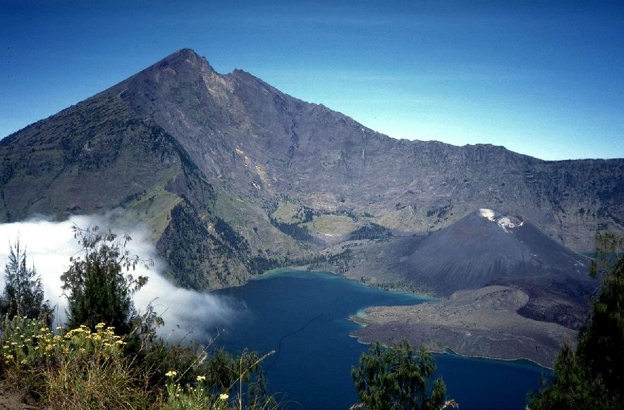
Mount Rinjani on the highest point of 3726 meters above sea level and dominates most of the views of the North Island of Lombok.
In the West there is a caldera cone Rinjani with an area of 3500 m × 4800 m, extends to the east and west. This boiler is Segara Anak (soon = sea, lake) area of 11 million square meters, with a depth of 230 m. Water flowing from the lake, forming a very beautiful waterfall flowing through a steep gorge. In Segara Anak many carp and tilapia, which are often used for fishing. The southern part of the lake known as Segara Endut.

On the eastern side of the boiler are New Mountain (or Mount Barujari), which has a crater of 170 mx 200 m with a height of 2296-2376 meters above sea level. This small mountain last active / split from the date of May 2, 2009 to May, after he also was broken in 2004. [2] [3] When the eruption in 2004 claimed no lives, erupted in 2009, the lives of 31 people died indirectly, a flash flood in the Crow (river) Tanggek lava insistence Segara Anak. [4] Prior, Mount Barujari burst ever recorded in 1944 (and device) 1966 and 1994.
Besides there are other craters Barujari mountain erupted, had called Mountain Group.

Tidak ada komentar:
Posting Komentar